SALT LAKE CITY (ABC4) – Happy Wednesday, Utah! We made it to the midweek and our warming trend is underway as a large ridge of high pressure dominates the western United States.
The bottom line? High pressure allows for above-average heat with a slight increase in southwest winds.
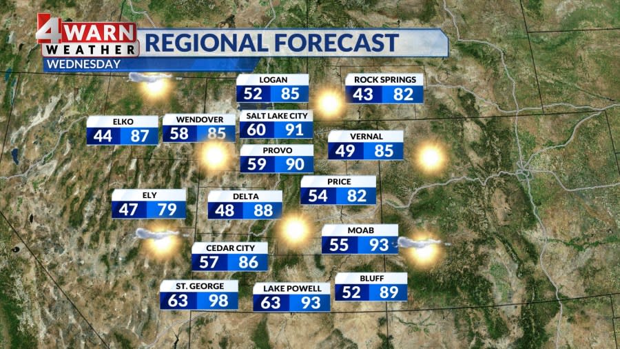

The high is roughly centered over Utah with dry air in the lower levels meaning we have another day of clear, sunny, and unseasonably warm temperatures ahead. Daytime highs will climb into the upper 80s and low 90s along the Wasatch Front with Salt Lake making a run for 91 degrees. We will see a solid mix in the 80s throughout Central Utah and temperatures reach the high 90s near Lake Powell and Washington County.
Overall, the state will see our temperatures running about eight to 15 degrees above seasonal norms for this time of year, meaning our first week of fall is really a nod to our summer heat!


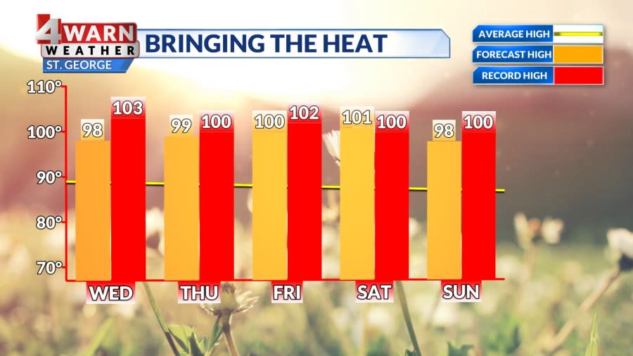

Speaking of summer heat, St. George has recorded 89 days of 100-degree or higher days this year! On average, the area typically sees 52 days of triple-digit heat, but this year has been a hot one, and we have seen several prolonged stretches of high heat. The 89 days of triple digits is the third-highest number on record for St. George with only two other years beating it, 1994 and 1996. We have the potential of two more triple-digit days this week in St. George, thanks to this strong ridge of high pressure, so we could secure the second-place spot this year by the weekend!
This strong ridge of high pressure also keeps us dry as it diverts weaker low-pressure systems north of Utah. For example, an area of low pressure from the Pacific Northwest will move inland and lift into Canada, but it may increase southwest winds Wednesday and into Thursday. The winds will help temperatures stay above average through the week.
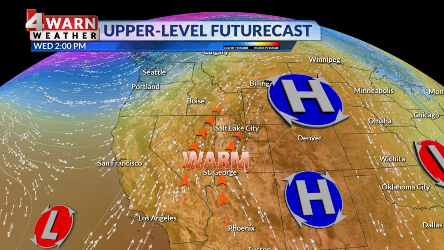

This high-pressure system will slightly weaken but keep a firm grip on the region through the weekend. It’s also worth noting that the latest 90-degree day on record for Salt Lake City is Sept. 30, but we have the potential this year to see those 90s hang for the weekend ahead of that date!
Right now, the ridge looks to linger through next Monday allowing for this unseasonable warmth, but the possibility of a dry cold front grazing Utah early next week is increasing which would knock down temperatures closer to average for this time of year. The overall trend is for above-average temps and below-average precipitation for the foreseeable future.
We’ll keep you posted on the latest developments in our 4Warn Weather forecast both on-air and online, we are Good4Utah!
Copyright 2024 Nexstar Media, Inc. All rights reserved. This material may not be published, broadcast, rewritten, or redistributed.
For the latest news, weather, sports, and streaming video, head to ABC4 Utah.
Source link : http://www.bing.com/news/apiclick.aspx?ref=FexRss&aid=&tid=66f4781278a74ab581e78aea09465728&url=https%3A%2F%2Fwww.yahoo.com%2Fnews%2Fmidweek-brings-summer-warmth-plenty-122015484.html&c=7411827289313710650&mkt=en-us
Author :
Publish date : 2024-09-25 01:20:00
Copyright for syndicated content belongs to the linked Source.


