Storm expected to bring heavy rain to North Carolina and Virginia
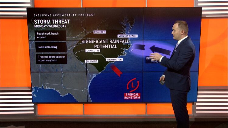
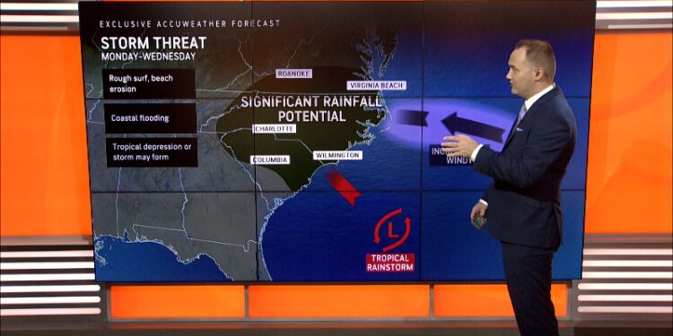
A tropical rainstorm that forecasters say could strengthen into a named storm this weekend is on a path toward the mid-Atlantic.
A potential tropical system brought rain totals usually not seen in hundreds of years to parts of southeastern North Carolina Monday, weather officials said, including “life-threatening flash flooding.”
The towns of Carolina Beach, Boiling Springs Lakes and Southport received more than a foot of rain in the first 12 hours of Monday, a weather event that on average occurs once every 200 years, according to the National Weather Service’s office in Wilmington, North Carolina.
The 18-plus inches in half a day that dropped on Carolina Beach occurs “once every 1000 years!” the office said.
The North Carolina Department of Transportation exhorted people in affected areas to avoid driving if possible on Monday, posting a photo of a collapsed and mostly submerged section of a street in Southport as the storm flooded dozens of roads.
The system, known as Potential Tropical Cyclone Eight, is forecast to move north across the Carolinas toward the Mid-Atlantic over the next day or so, according to the NWS, with “persistent showers and thunderstorms” expected across portions of North Carolina and the southern Mid-Atlantic on Tuesday, and locally heavy rainfall could result in “isolated to scattered instances of flash flooding.”
Flood watches are in effect Tuesday for portions of southeastern Virginia and North Carolina, with precipitation coverage and density expected to decrease on Wednesday.
“By Thursday, this system will begin to shift offshore into the Atlantic and high pressure will build behind it,” the NWS said Tuesday morning.
Rare meteorological feat: A once-in-200-years event: NC towns get a foot of rain in 12 hours
National Hurricane Center tracking Tropical Depression Gordon, three additional tropical waves
The National Hurricane Center said Tuesday morning it is continuing to track Tropical Depression Gordon, which is currently located about 925 miles east of the northern Leeward Islands.
The NHC said the depression is moving west, however it is expected to take a turn to the north Tuesday, following by a turn toward the north-northeast on Wednesday.
Gordon currently has sustained winds near 35 mph, with higher gusts, and it could gradually re-intensify into a tropical storm again later this week, the NHC said.
The hurricane center is also tracking three tropical waves in the Atlantic, forecasters said Tuesday morning.
An eastern Atlantic tropical wave is along 27W, south of 20N, and moving westward at 5-10 knots, the NHC said. Additionally, a central Caribbean tropical wave is “enhancing the scattered showers and thunderstorms” over northern Colombia and south-central portions of the Caribbean Sea, according to the NHC.
Lastly, a tropical wave is extending from southern Yucatan to Guatemala and into the Eastern Pacific, with the NHC noting a few showers near this system.
Tropical Depression Gordon trackerTropical Depression Gordon spaghetti models
Spaghetti model illustrations include an array of forecast tools and models, and not all are created equal. The Hurricane Center uses only the top four or five highest performing models to help make its forecasts.
Gabe Hauari is a national trending news reporter at USA TODAY. You can follow him on X @GabeHauari or email him at [email protected].
Source link : https://www.usatoday.com/story/news/weather/2024/09/17/storm-tracker-north-carolina-flooding-gordon-path-atlantic/75259906007/
Author :
Publish date : 2024-09-17 01:25:00
Copyright for syndicated content belongs to the linked Source.


