A developing storm off the Carolina coast could evolve, make landfall and potentially stall over land for several days, AccuWeather meteorologists warn. This weekend, an area of low pressure is expected to gather over warm waters just off the coast, possibly transforming into a tropical depression or tropical storm early next week.
Showers and thunderstorms blossomed in the zone on Thursday. Seas and surf were already being agitated by easterly breezes created around high pressure to the north.
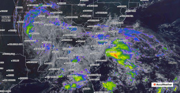

This image, captured on Friday, Sept. 13, 2024, shows a lingering circular motion to the clouds associated with Francine over the mid-Mississippi Valley (left of center) and a developing circular motion to the clouds off the Carolina coast (right of center). AccuWeather Enhanced RealVue™ Satellite.
The combination of the lingering high in the Northeast and a strengthening low-pressure area off the Carolinas will stiffen winds even further and cause seas and surf to build in the stretch of the Atlantic coast from northeastern Florida to the Delmarva Peninsula into next week.
AccuWeather meteorologists began referring to the system as a tropical wind and rainstorm at midweek to help raise public awareness of conditions that could put lives and property at risk and help officials plan and prepare.
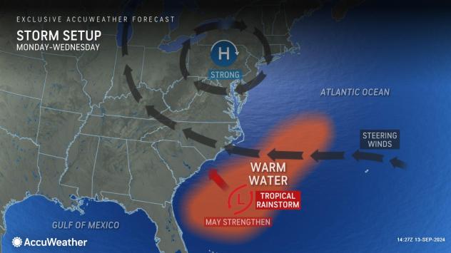

Homegrown development such as this is much more common in the late spring to early summer. Most tropical systems during the heart of the hurricane season develop thousands of miles to the south, over the central Atlantic.
Regardless of the official tropical designation by the National Hurricane Center, powerful surf with frequent and strong rip currents will occur while beach erosion ramps up.
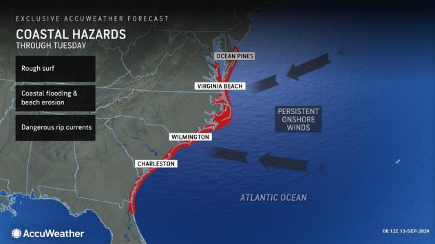

Moderate coastal flooding is anticipated, which will be worse at times of high tide. Some access roads to the barrier islands may be blocked by high water or damaged by erosion. Beachfront homes may be at risk.
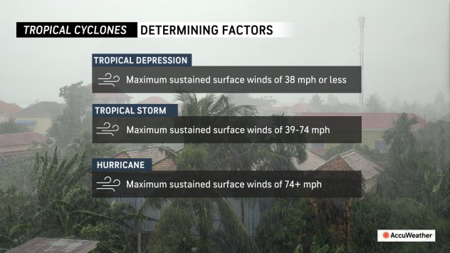
For a tropical depression to be declared, the system must have a warm core with a defined circulation and sustained winds less than 39 mph. The same conditions with winds of 39-73 mph designate a tropical storm.

There may be far more extensive impacts from the homebrew storm.
“A prolonged period of moisture funneling in from both the Gulf of Mexico and the Atlantic Ocean will result in areas of heavy rain with a heightened flood threat across portions of the Southeast through the weekend and into next week,” AccuWeather Meteorologist Brandon Buckingham said.
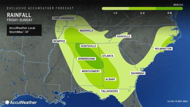

Should the system move inland and stall, several inches to a foot of rain may fall well beyond Sunday, quickly reversing any drought problems and leading to flooding in urban areas, small streams and perhaps some rivers.
GET THE FREE ACCUWEATHER APP
Some of the moisture will be associated with Francine, with its stretched-out zone of rain and thunderstorms, as well as a developing storm at the level of the atmosphere where jets fly. Moisture from Francine, the jet stream storm and the budding tropical system will gradually become intertwined over the Southeast states.
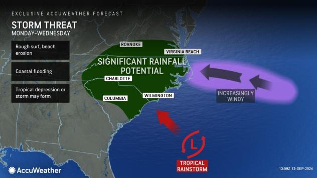

The exact track and intensity of the homegrown tropical wind and rainstorm will determine which areas receive the most rain. The track of the system depends on how quickly it develops as well as the strength and position of the high-pressure zone over the Northeast states.
A westward track might bring the heaviest rain to the Carolinas and part of Georgia from this weekend into next week.
A track to the northwest may send much of the rain into Virginia, the Delmarva Peninsula and perhaps even into northern Maryland, Pennsylvania and New Jersey by the middle of next week. Should this occur, it would break a long string of days with dry weather that began around Sept. 8.
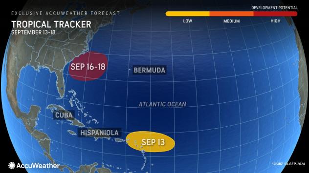

There is also a small chance the core of the budding storm stays at sea and wanders northward off the New England coast. This scenario is most likely if development is delayed until the middle or latter part of next week.
Elsewhere in the Atlantic, a tropical depression (seven) formed earlier this week over the central Atlantic. At midday on Friday, NHC upgraded the depression to Tropical Storm Gordon with sustained winds of 40 mph. Gordon is likely to remain at sea with no threat to land for at least the next week.
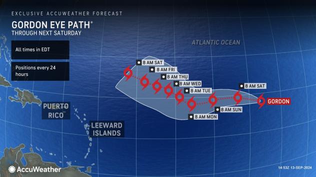

Following Gordon, the next name on the list of tropical storms for the 2024 Atlantic hurricane season is Helene.
Want next-level safety, ad-free? Unlock advanced, hyperlocal severe weather alerts when you subscribe to Premium+ on the AccuWeather app. AccuWeather Alerts™ are prompted by our expert meteorologists who monitor and analyze dangerous weather risks 24/7 to keep you and your family safer.
Source link : http://www.bing.com/news/apiclick.aspx?ref=FexRss&aid=&tid=66e490beda354f20b8986091997d693d&url=https%3A%2F%2Fwww.aol.com%2Ftropical-trouble-brewing-near-carolina-160552358.html&c=5176062212981182835&mkt=en-us
Author :
Publish date : 2024-09-13 08:05:00
Copyright for syndicated content belongs to the linked Source.


