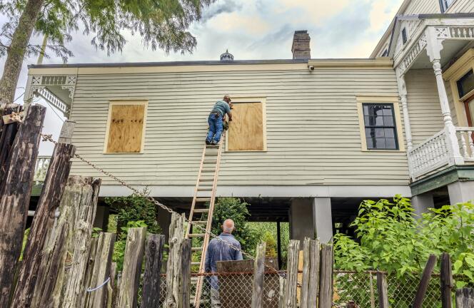
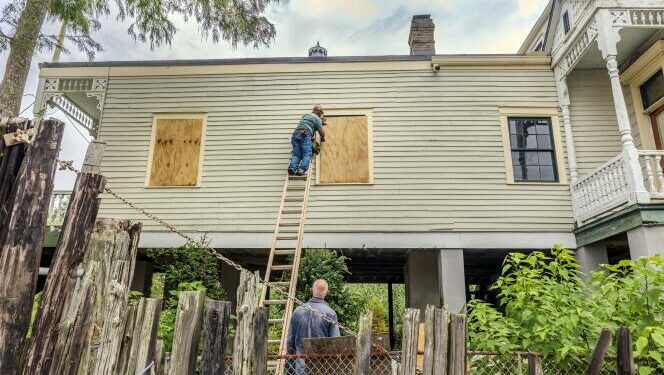
 The windows of a raised historic house are boarded up as residents prepare for the arrival of Hurricane Francine along the Louisiana coast on Sept. 9, 2024, in Lafitte, Louisiana. CHRIS GRANGER / AP
Tropical Storm Francine strengthened Monday, September 9, in the Gulf of Mexico and was forecast to make landfall as a hurricane this week in Louisiana, where evacuation orders were quickly issued in some coastal communities and residents began filling sandbags in preparation for heavy rains and widespread flooding.
Francine, the sixth named storm of the Atlantic hurricane season, was expected to become a hurricane shortly, the US National Hurricane Center in Miami said Monday night. The storm was already being felt in Mexico, where drenching rains closed schools as the storm gathered strength in the Gulf.
Louisiana Gov. Jeff Landry urged residents “not to panic, but be prepared” and heed evacuation warnings. Forecasters said Francine’s landfall in south Louisiana was expected Wednesday afternoon as a Category 2 hurricane with winds of 96 to 110 mph (155-175 kph).
Francine is taking aim at a Louisiana coastline that has yet to fully recover since hurricanes Laura and Delta decimated Lake Charles in the region in 2020, followed a year later by Hurricane Ida. Over the weekend, a 22-story building in Lake Charles that had become a symbol of storm destruction was imploded after sitting vacant for nearly four years, its windows shattered and covered in shredded tarps.
‘Potential for dangerous, life-threatening inundation’
Francine’s storm surge on the Louisiana coast could reach as much as 10 feet (3 meters) from Cameron to Port Fourchon and into Vermilion Bay, forecasters said. “It’s a potential for significantly dangerous, life-threatening inundation,” said Michael Brennan, director of the hurricane center, adding it could also send “dangerous, damaging winds quite far inland.”
He said landfall was likely somewhere between Sabine Pass – on the Texas-Louisiana line – and Morgan City, Louisiana, about 220 miles (350 kilometers) to the east.
Louisiana officials urged residents to immediately prepare while “conditions still allow” for it, Mike Steele, spokesperson for the Governor’s Office of Homeland Security and Emergency Preparedness, told The Associated Press. He warned Francine could rapidly intensify.
Residents of Baton Rouge, Louisiana’s capital, began forming long lines as people filled gas tanks and stocked up on groceries. Others filled sandbags at city-operated locations to protect homes from possible flooding.
New
Le Monde’s app
Get the most out of your experience: download the app to enjoy Le Monde in English anywhere, anytime
Download
A mandatory evacuation was ordered for seven remote coastal communities by the Cameron Parish Office of Homeland Security & Emergency Preparedness. They include Holly Beach, a laid-back stretch dubbed Louisiana’s “Cajun Riviera,” where many homes sit on stilts. The storm-battered town has been a low-cost paradise for oil industry workers, families and retirees, rebuilt multiple times after past hurricanes.
Shelter in place in New Orleans
In New Orleans, Mayor LaToya Cantrell urged residents to prepare to shelter in place. City officials said they were expecting up to 6 inches (15 centimeters) inches of rain, gusty winds and “isolated tornado activity” with the most intense weather likely to reach New Orleans on Wednesday and Thursday.
Read more Subscribers only El Niño is ending, but the planet will continue to overheat
The hurricane center said Francine was last about 145 miles (235 kilometers) south-southeast of the mouth of the Rio Grande, and about 425 miles (690 kilometers) south-southwest of Cameron, with top sustained winds of about 65 miles per hour (100 kilometers per hour). It was moving north-northwest at 7 mph (11 kph).
The storm was expected to move in north-northeast motion through Monday evening and then accelerate to the northeast beginning Tuesday before nearing the upper Texas and Louisiana coastlines Wednesday.
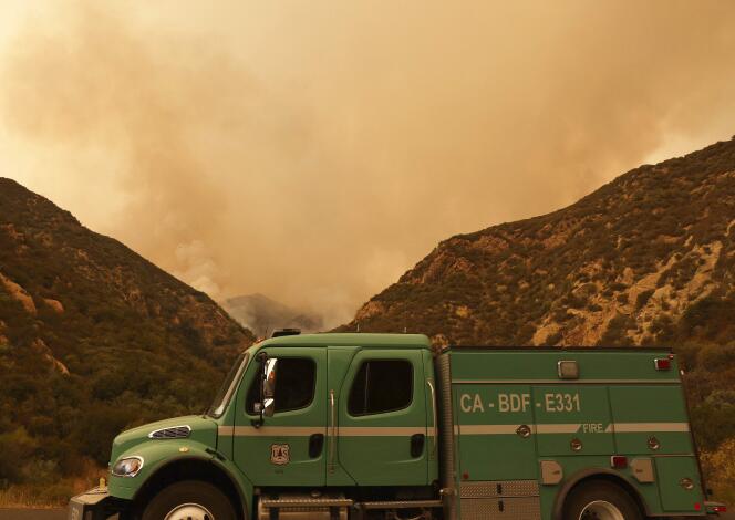
 Smoke rises as the Line Fire burns on September 9, 2024, near Yucaipa, California. MARIO TAMA / AFP Bulldozers, helicopters and airplanes
As wildfire continues to spread east of Los Angeles, southern California mountain community residents are mulling whether to stay and protect their homes or leave. Cal Fire spokesperson Rick Carhart said the fire led at least 6,000 people to evacuate. “We’re dealing with triple-digit temperatures and hard-to-reach steep areas where there has not been fire in decades, or in recorded history, so all that vegetation has led to significant fuel loads,” Carhart said.
Mara Rodriguez, a spokesperson with the San Bernardino County Sheriff’s Department, which issues evacuation orders, said nearly 5,000 homes fell under the existing orders and nearly 17,000 more were under evacuation warnings.
The blaze threatened thousands of home and commercial structures as it burned along the edge of the San Bernardino National Forest, about 65 miles (105 kilometers) east of Los Angeles. As of Monday morning, it was 3% contained.
Firefighters were using bulldozers, helicopters and airplanes Monday to control a rapidly spreading blaze that broke out near a remote-controlled airplane airport in Orange County southeast of Los Angeles. The fire spread to about 3 square miles (7.8 square kilometers) in only a few hours.
In Northern California, a fire measuring less than a square mile (2.6 square kilometers) started Sunday and burned at least 30 homes and commercial buildings and destroyed 40 to 50 vehicles in Clearlake City, 110 miles (117 kilometers) north of San Francisco, officials said. Roughly 4,000 people were forced to evacuate by the Boyles Fire, which was about 10% contained Monday morning.
Read more Subscribers only California’s Park Fire has become the state’s seventh-largest wildfire in less than 72 hours
The fires are among the most dangerous of the many burning in various parts of California.
Smoke rises from the Bear fire as pictured from Reno, Nevada, on September 3, 2024, in this picture obtained from social media. PAULINE WOOLDRIDGE / PAULINE WOOLDRIDGE VIA REUTERS A blaze so hot it creates thunderstorm-like weather systems
About 20 miles (32.2 kilometers) outside Reno, Nevada, the uncontained Davis Fire grew to about 10 square miles (26 square kilometers) after igniting Sunday afternoon. An emergency declaration issued for Washoe County by Gov. Joe Lombardo on Sunday noted that about 20,000 people were evacuated from neighborhoods, businesses, parks and campgrounds. Parts of south Reno remained under the evacuation notice on Monday, firefighters said, and some homes, businesses and traffic signals in the area were without power.
The Southern California blaze burned so hot Saturday that it created its own thunderstorm-like weather systems of pyrocumulus clouds, which can create more challenging conditions such as gusty winds and lightning strikes, according to the National Weather Service.
The Reno fire is roughly 480 miles (770 kilometers) to the northeast of the blaze in the San Bernardino National Forest, where firefighters worked in steep terrain in temperatures above 100 degrees (38 Celsius), limiting their ability to control the blaze, officials said. State firefighters said three firefighters had been injured.
Evacuations were ordered Saturday evening for Running Springs, Arrowbear Lake, areas east of Highway 330 and other regions. Redlands Unified School District canceled Monday classes for roughly 20,000 students, and Gov. Gavin Newsom proclaimed a state of emergency for San Bernardino County.
Read more Subscribers only The summer of 2024 was the hottest on record globally
Reuse this content
Source link : http://www.bing.com/news/apiclick.aspx?ref=FexRss&aid=&tid=66dffbda0751453694392c5f5b7ee8bf&url=https%3A%2F%2Fwww.lemonde.fr%2Fen%2Fenvironment%2Farticle%2F2024%2F09%2F10%2Fextreme-weather-in-the-us-louisiana-residents-brace-for-hurricane-residents-flee-fires-in-la-and-nevada_6725437_114.html&c=6952628026960256385&mkt=en-us
Author :
Publish date : 2024-09-09 12:40:00
Copyright for syndicated content belongs to the linked Source.


