Shortly after the sun rises in Reno, the city’s summer temperatures are already withering.
The Biggest Little City constantly hovers in the 90s and often dips its toes into the 100s. Plants droop. Pedestrians seek out the shady side of the street — or wait until the sun goes back down.
It is, in short, hot.
But that heat is not spread equally across the city.
In some communities, mature trees shade sidewalks. Well-insulated houses shelter their residents from temperature swings.
In other neighborhoods, seas of asphalt absorb (and later release) heat. Parking lots outnumber trees. Older houses and trailers bake under the scorching heat.
It’s the temperature differences between these neighborhoods, and all other Northern Nevada communities, that a group of volunteer citizen scientists will track through an urban heat mapping effort later this summer.
Early one morning, the dozens of volunteers will fan out across Northern Nevada, driving along preplanned routes with temperature and humidity sensors attached to their passenger-side windows. They will head out again in mid-afternoon, the hottest part of the day, and again in the evening as temperatures — hopefully — begin to cool to capture snapshots of what heat disparities look like across Northern Nevada.
The project is part of the National Oceanic and Atmospheric Association’s (NOAA) Heat Island Mapping Campaign, an ongoing effort to collect detailed heat-related data from cities around the world. For nearly a decade, NOAA and federal partners have worked with local agencies and volunteers to take point-in-time temperature measurements in urban areas; Las Vegas participated in the project in 2022.
The goal of the project is not just to measure temperatures — the National Weather Service tracks those at Harry Reid International Airport in Las Vegas and the Reno-Tahoe International Airport — but to also measure the spectrum of temperatures across urban areas to understand what pockets hold the most heat. Known as heat islands, these areas are a growing problem as the climate warms.
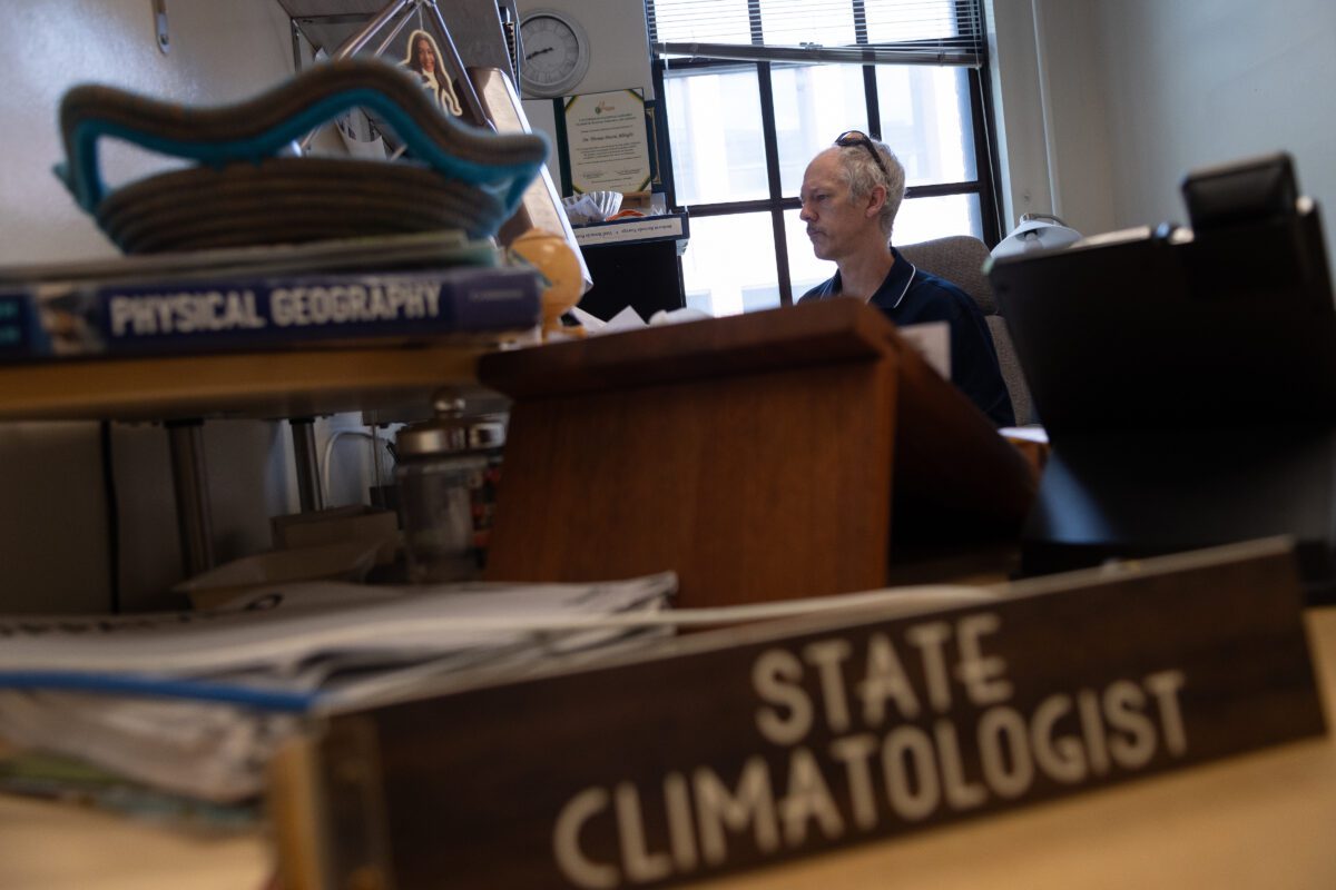 Tom Albright, PhD., a geography professor at the University of Nevada, Reno and interim state climatologist, inside his office on campus on Aug. 2, 2024, in Reno. (David Calvert/The Nevada Independent)
The singular temperature measured by the weather service does not represent the experience of an entire city, said Tom Albright, the Nevada state climatologist and UNR geography professor who is leading the Reno project.
“Like so many environmental and public health issues, this affects us in very disparate ways across different populations,” he said. “Being able to see how much warmer certain areas are than others is an important starting point of ‘how do we make this better?’ ‘How do we solve these problems?’”
In Las Vegas, data uncovered during the 2022 mapping effort showed a double-digit difference between the warmest and coolest parts of the city on any given day.
Observations and data gathered through the heat mapping projects “help us gain traction and visibility and will call policy makers and practitioners’ attention to start worrying about it,” said John Mejia, atmospheric modeler at the Desert Research Institute (DRI). When those in power start worrying about extreme heat, he said, it will “eventually help bring the resources for us to address it head on.”
“The problem is only starting. This idea of the urban heat island and climate adaptation plans to make cities cooler is just starting.”
Urban areas that typically experience the hottest temperatures are those lacking dense vegetation and featuring dark, impermeable surfaces such as parking lots, buildings and asphalt — features known to have a strong correlation to increased surface temperatures.
Those neighborhoods are often older and lower income, drawing a socioeconomic line between those who are hot, and those who are even hotter.
In Reno, the mapping prioritized schools, community centers, sporting facilities and along transportation corridors — places where people tend to gather outside.
“This is a systemic issue. When you start talking about extreme heat, you are talking about so many other issues — health disparities, historically underserved communities, climate change,” said Ariel Choinard, a research scientist and project coordinator at DRI’s Southern Nevada Heat Resiliency Lab. “You start pulling on the thread of heat and you start pulling on so many other threads as well.”
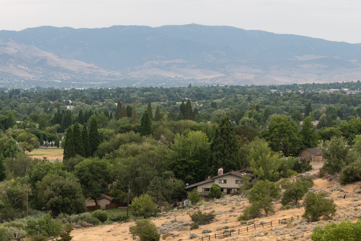 Homes to the south of Bartley Ranch Regional Park in Reno on Aug. 2, 2024. (David Calvert/The Nevada Independent)
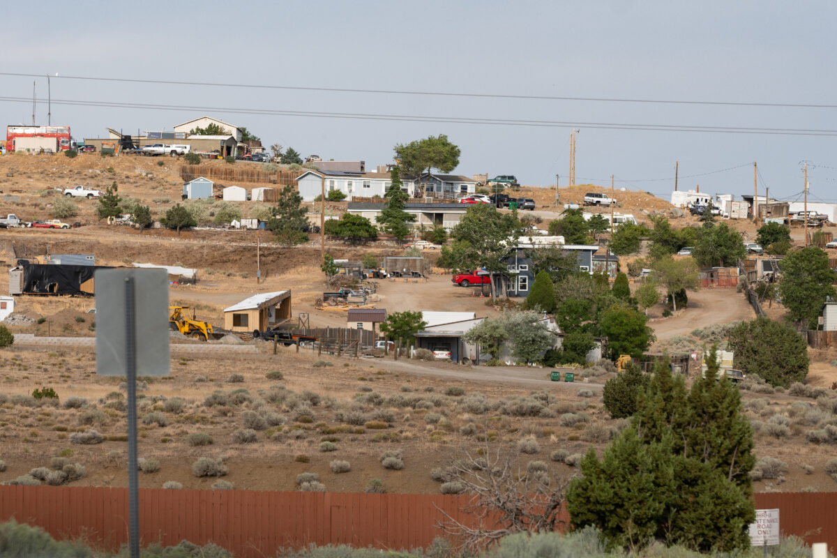 Homes in Sun Valley on Aug. 2, 2024, in Reno. (David Calvert/The Nevada Independent)
Heat as a chronic stressor
July wasn’t just hot — it was record-shattering in Nevada.
Between July 6 and 12, Reno reached 105 degrees four times and 106 once, breaking previous records. It was the most consecutive 105-degree days in the city’s history.
In Las Vegas, temperatures reached a record-high 120 degrees July 7, and the city saw 11 consecutive days with temperatures of 110 degrees or higher.
When Southern Nevada reached 120 degrees, Choinard and her daughter weren’t in town — they were somewhere even hotter.
They were driving through Baker, California, where the temperature reached 124 degrees. Choinard stepped out of her car briefly and even her eyeballs felt hot.
“It was shocking,” Choinard said. “It’s kind of overwhelming. You can’t even think straight.”
During the heatwave, temperatures didn’t cool down too much at night. Higher nighttime temperatures are partially caused by impermeable surfaces such as asphalt capturing heat during the day, which then release the heat after the sun goes down.
With rising nighttime temperatures, there’s no relief from the heat for many people, including those who can’t afford or don’t have access to air conditioning.
Heat can act as a chronic stressor, Choinard said, with the cumulative effects of heat taking its toll on those who are repeatedly exposed to it.
In a 2021 nationwide study, scientists broke down race and class disparities in more than 1,000 counties across the United States to look at who lives in the hottest areas. They found that “while the social, political and economic drivers of these disparities may differ, the structure of the built environment driving these changes are quite uniform.”
In nearly three-quarters of the counties studied, neighborhoods with more people of color and lower incomes generally saw higher temperatures than wealthier, white Americans.
“There’s a lot of historical injustice built into who is most vulnerable to heat and why,” Choinard said.
 Southwest Airlines airplanes at Harry Reid International Airport on May 24, 2023. (Jeff Scheid/The Nevada Independent)
Las Vegas heat mapping
The Reno heat mapping project builds on a 2022 urban heat mapping project undertaken in Southern Nevada with the same federal agencies.
That year, the mapping took place in mid-August. It was unseasonably cool, with temperatures reaching just 90 degrees at Harry Reid International Airport, 13 degrees below the historical average of 103 degrees.
The night before, local thunderstorms brought in heavy cloud cover that lingered into the day. The amount of direct solar radiation an area receives influences the heat island effect, and the cloud cover may have lowered the range of temperatures the area would have otherwise seen. But scientists still believe the data collected that day accurately depicted which communities were hotter than others.
The mapping found that the highest temperatures in Southern Nevada were concentrated in the central and eastern portions of the Las Vegas Valley, though localized hot spots were found throughout the region.
Neighborhoods with the hottest temperatures were located around the urban core in downtown Las Vegas, downtown North Las Vegas and in the Historic Westside, and around East Las Vegas and east of US. Highway 95.
Notably, the mapping effort showed an 11-degree difference between Las Vegas’ hottest and coolest neighborhoods, a difference that was “very revealing,” Choinard told Nevada lawmakers at an interim meeting last month.
“Think about what that might mean on the day when it’s 120 degrees,” Choinard said during the meeting.
The Las Vegas heat mapping project, in turn, built off a 2021 study by the Regional Transportation Commission of Southern Nevada that found 115,000 people lived in the most heat vulnerable areas of the Las Vegas Valley. One quarter of those residents were 50 or older, and 80 percent were people of color. Their average median household income was $31,000, less than half of the countywide median income.
The differences across Las Vegas are “extraordinarily stark,” Choinard said. “There are so many inequalities at the heart of this conversation.”
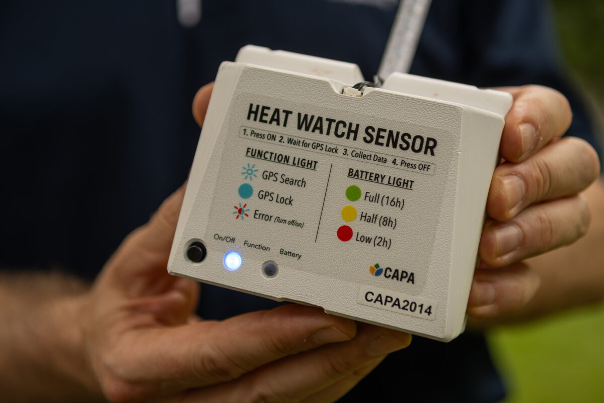 A sensor used to map heat on Aug. 2, 2024, in Reno. (David Calvert/The Nevada Independent)
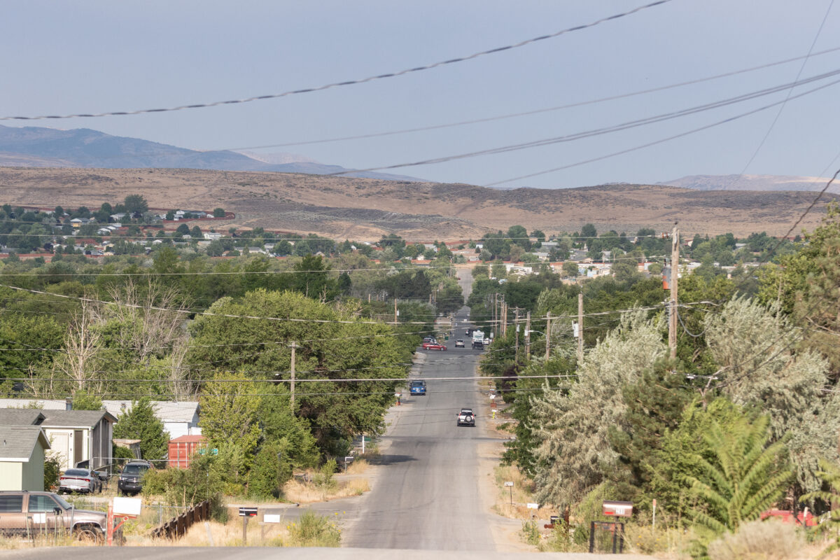 Sun Valley on Aug. 2, 2024, in Reno. (David Calvert/The Nevada Independent)
‘Just don’t be hot.’
Rising Nevada temperatures have led to groups such as the nonprofit Climate Central to rank Reno and Las Vegas among the fastest warming cities in the nation.
“These are communities seeing a lot of population growth. A lot of parking lots. A lot of big car-centric transfer stations. Roads. Air conditioning to the hilt,” Albright, the state climatologist, said.
Combined with Nevada’s arid climate and topography, it’s not surprising the two cities rank among the fastest warming, he said.
And as temperatures have increased, so have deaths.
The number of people who died from heat exposure rose nearly fourfold between 2015 and 2021 in Southern Nevada; in 2022, the Southern Nevada Health District recorded 152 heat-related deaths. As of July 30, the Clark County Coroner’s Office had confirmed 63 deaths related to heat.
In an analysis of Centers for Disease Control and Prevention data, the Associated Press found that more than 2,300 people died of excessive heat nationwide in 2023, the highest number in nearly 50 years. Nearly three-quarters of those deaths were recorded in five states, including Nevada.
“We are attributing all these deaths to heat, and it feels like there should be something we can do about it, and the first thing to do is enhance the information we have,” Mejia said, citing the need for heat mapping projects such as the one in Reno.
Northern Nevada Public Health does not track heat-related deaths, a department spokesperson said.
While Nevada code outlines what health departments should report, heat is not among those conditions listed.
According to the World Health Organization, nearly a half million people died each year between 2000 and 2019 from heat. The organization ranks it among the most dangerous natural hazards.
There are limited protections in place to help those who can’t afford to cool off. In Nevada, a utility cannot turn electricity off for bill nonpayment once the temperature reaches 105 degrees; that threshold is lowered to 95 degrees for those who are elderly or disabled.
But that still leaves many Nevadans suffering in the heat and doesn’t account for temperature differences within cities.
Few resources are available to address the problem, Choinard said, compared to other issues such as public safety.
Washoe and Clark counties each activate cooling centers when the National Weather Service issues extreme heat warnings.
Those cooling centers, however, might be nothing more than a chair in a library or senior center, making it a challenge for those with children or who need access to a workspace, Choinard said.
“This is the only large-scale response we have to heat,” Choinard said. “When it gets really hot, we just tell people, ‘Just don’t be hot.’ Cooling is seen as a luxury still.”
Using data gathered during mapping can help develop policies and implement best practices to better deal with the heat, Albright said, such as creating locally tailored heat warning systems.
“If you can’t reduce that heat island, be smarter about how you deal with it,” he said.
That can include planting trees or converting to lighter-colored structures and paving surfaces that don’t absorb as much heat, Mejia added.
When he travels through a city, he pays attention to the people and their surroundings. Are there canopies over bus stops? What kind of air-conditioning units are people using? Is there green infrastructure, or vast swaths of asphalt?
What works in one city to reduce warming might not work in another, he said. But while large-scale plans are developed, small steps can still be taken.
“You are underneath a tree at noon in Vegas, you will feel it,” he said. “A single tree matters.”
Source link : http://www.bing.com/news/apiclick.aspx?ref=FexRss&aid=&tid=66b07ebeb0cb49a1bbca0f4b15659f31&url=https%3A%2F%2Fthenevadaindependent.com%2Farticle%2Ffinding-renos-hot-spots-volunteers-measure-northern-nevadas-warmest-neighborhoods&c=695290147492603765&mkt=en-us
Author :
Publish date : 2024-08-03 22:19:00
Copyright for syndicated content belongs to the linked Source.

