The forecast for Helene to transition from a potential tropical cyclone to a Category 3 hurricane appears to be the fastest progression ever predicted for a depression by the National Hurricane Center.
“They had never forecast a major hurricane within 60 hours for a disturbance below tropical storm level,” said Sam Lillo, a meteorologist and software engineer for DTN Weather, based on a computer analysis of the center’s historical forecast data. “The entire forecast is also basically faster than has ever been seen for 36 hours and 48 hours from a tropical depression.”
The National Hurricane Center didn’t have that stat at the ready Tuesday as they were focused on operational forecasting for Helene, now a tropical storm, but “it’s either the highest or one of the highest,” said John Cangialosi, one of the center’s senior hurricane specialists.
The forecast for a “70-knot increase in 72 hours on Monday was among the most aggressive forecasts” for a potential tropical cyclone, Cangialosi said.
“It’s an aggressive forecast for good reason,” he said. “We’re trying to get ahead of the possible rapid intensification before it gets to Florida.”
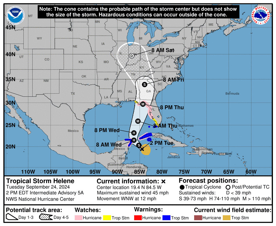
Helene is forecast to make landfall along or near Florida’s Big Bend on Thursday evening with widespread wind, rain and storm surge impacts throughout the Southeast, but its exact track and timing could still shift, the hurricane center said Tuesday.
Latest on Helene: Florida bracing for major hurricane hit


The National Hurricane Center’s forecast cone for Tropical Storm Helene as of Sept. 24, 2024, at 2 p.m.
What computer models show in Helene’s forecast
Among the array of computer models used to forecast storms, some continue to call for even more aggressive strengthening in Helene and for dramatic drops in pressure that could put it among the lowest ever recorded in the Gulf of Mexico.
These forecasts are “likely a bit overboard for what is realistic,” Lillo said. The models face two challenges: Helene’s larger than average size and its still sloppy organization as of Tuesday afternoon.
“Larger storms tend to intensify a little slower, which will put a little bit of a cap on the maximum intensity it could reach by landfall,” Lillo said.


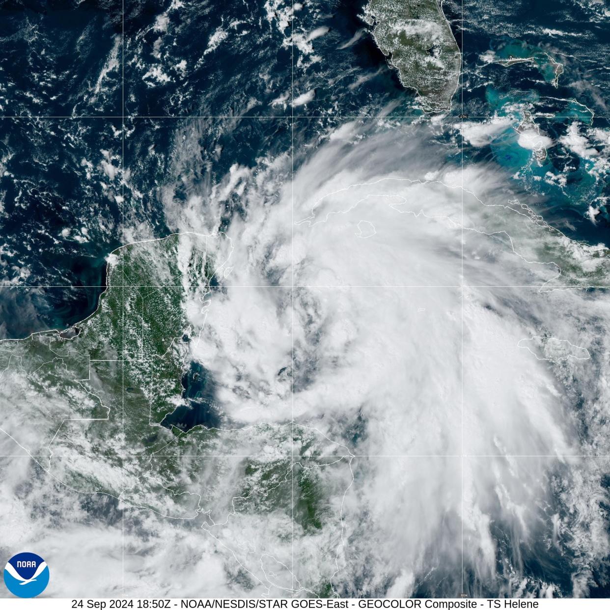
Tropical Storm Helene on satellite in the western Caribbean on Sept. 24, 2024.
The models have been struggling because the storm isn’t yet fully organized and remains lopsided, and most of the intense convective clouds are still east of the center, said David Roth, a meteorologist with the Weather Prediction Center. Helene didn’t officially become a tropical storm until 11 a.m. on Tuesday.
The models are known to get “overly intense” sometimes in those situations, Roth said.
Fortunately, the hurricane center is familiar with biases like this that exist in the models, he said. For every model predicting a super intense storm, another model has a bias in the other direction and they wind up canceling each other out as the official forecast is prepared.
What does Helene’s future forecast hold?
The hurricane center and the National Weather Service typically advise residents in the path of a storm to plan for one category higher than forecast, and for now Helene is forecast to be a Category 3 at landfall, with 115-mph winds.
Ultimately, the limiting factor for peak wind speeds and lowest pressure is how fast the center of circulation gets organized now that it has formed.
“That’s what we’ve been waiting on for the last 24 to 36 hours,” Lillo said. “As soon as it’s organized and tightens up, that’s when it can take advantage of the very hot temperatures in the Gulf.”
Dinah Voyles Pulver covers climate change and the environment for USA TODAY. She’s been writing about hurricanes, tornadoes and violent weather for more than 30 years. Reach her at dpulver@gannett.com or @dinahvp.
This article originally appeared on USA TODAY: Helene is almost a hurricane. See how path intensified
Source link : http://www.bing.com/news/apiclick.aspx?ref=FexRss&aid=&tid=66f35761390f4b6c9d00467b5dcc9f57&url=https%3A%2F%2Fwww.aol.com%2Fhelenes-explosive-forecast-one-most-205534882.html&c=17957051986409922160&mkt=en-us
Author :
Publish date : 2024-09-24 12:55:00
Copyright for syndicated content belongs to the linked Source.