Tropical Storm Ernesto expected to strengthen as it approaches Bermuda
Forecasters say Tropical Storm Ernesto could strengthen into a Category 3 hurricane over the coming week.
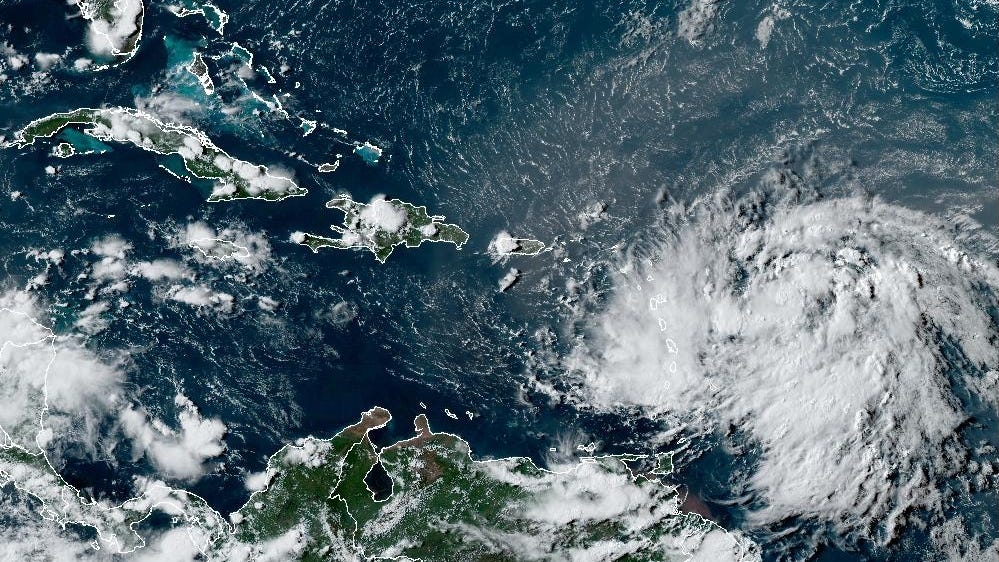
A tropical wave in the western Atlantic strengthened into Tropical Storm Ernesto Monday afternoon and is continuing to strengthen Tuesday.
Ernesto is expected to become a hurricane Tuesday night and could flirt with becoming a major hurricane later in the week, according to the latest advisory from the National Hurricane Center.
➤ Track Tropical Storm Ernesto
➤ Weather alerts via text: Sign up to get updates about current storms and weather events by location
While most spaghetti models show Ernesto on a path toward Bermuda by the weekend, dangerous surf and rip currents could affect Florida and the eastern coast of the United States.
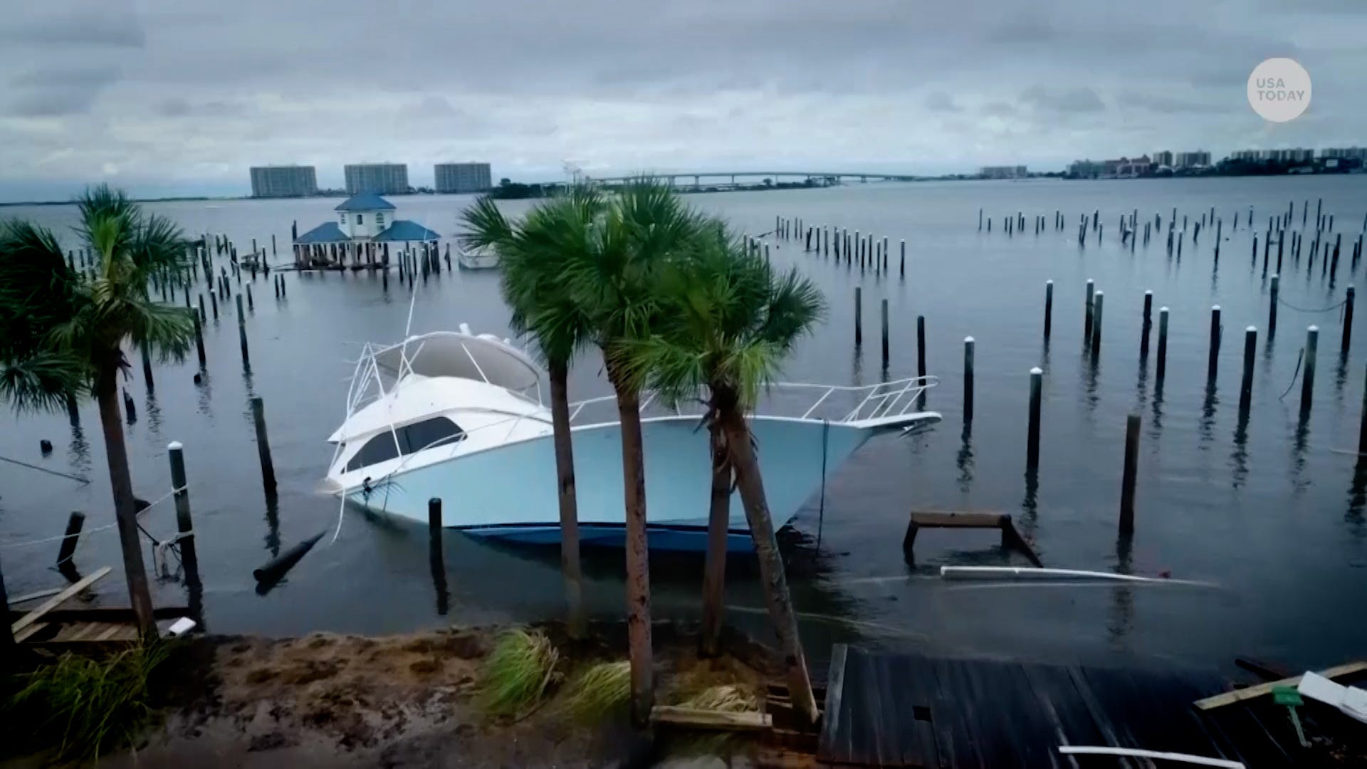
The formation of the latest storm comes just over a week after Hurricane Debby made landfall on Florida’s Big Bend Monday, Aug. 5.
AccuWeather forecasters said Ernesto has the potential of “ramping up to a major hurricane for a time before setting its sites on Bermuda.”
A major hurricane is one with sustained winds of at least 111 mph, making it a Category 3 storm or higher.
Tropical Storm Ernesto: What you need to knowLocation: 65 miles east-southeast of St. Thomas; 135 miles east-southeast of San Juan, Puerto RicoMaximum sustained winds: 60 mphMovement: west-northwest at 18 mphPressure: 1,001 mb
➤ En Español
Watches, warnings issued across Florida
No watches or warning connected to Tropical Storm Ernesto have been issued for Florida.
The National Hurricane Center has issued the following warnings:
Hurricane watch:
U.S. Virgin IslandsBritish Virgin IslandsVieques and Culebra
A hurricane watch means that hurricane conditions are possible within the watch area, in this case within the next 12 hours or so.
Tropical storm warning:
St. Kitts, Nevis, Montserrat, Antigua, and AnguillaSt. Martin and St. BarthelemySint MaartenSaba and Sint EustatiusBritish Virgin IslandsU.S. Virgin IslandsPuerto RicoVieques and Culebra
A tropical storm warning means that tropical storm conditions are expected somewhere within the warning area within 36 hours.
How strong is Tropical Storm Ernesto and where is it going?
At 5 p.m., the center of Tropical Storm Ernesto was located near latitude 18.0 North, longitude 64.1 West.
Ernesto is moving toward the west-northwest near 18 mph.
A turn toward the northwest with a gradual decrease in forward speed is expected tonight, followed by a turn toward the north-northwest and north Wednesday night and Thursday.
➤ Track all active storms
On the forecast track, the center of Ernesto should pass near or over the Virgin Islands this evening, and then pass just to the northeast and north of Puerto Rico tonight and on Wednesday.
Ernesto should then move over the western Atlantic later in the week and be near Bermuda by Friday. Data from an Air Force Reserve Hurricane Hunter aircraft indicate that maximum sustained winds are near 60 mph with higher gusts.
Strengthening is forecast, and Ernesto is expected to become a hurricane by tonight to the north of the Virgin Islands and Puerto Rico.
Tropical-storm-force winds extend outward up to 115 miles from the center. A wind gust of 54 mph was recently reported at St. Martin.
The estimated minimum central pressure is 1001 mb.
Spaghetti models for Tropical Storm Ernesto
Special note about spaghetti models: Illustrations include an array of forecast tools and models, and not all are created equal. The Hurricane Center uses only the top four or five highest performing models to help make its forecasts.
➤ Tropical Storm Ernesto
Stay informed. Get weather alerts via textPredicted impact on Florida from Tropical Storm Ernesto
“Currently, the weather along the southeastern U.S. coast looks fairly nice this weekend, so even if the storm remains well offshore, coastal impacts such as rough surf and rip currents could spell trouble for beach-goers trying to soak up the last weekends of summer,” said AccuWeather Meteorologist Emma Belscher.
An impact on Florida, the Bahamas and the southeastern U.S. depends on steering winds in the atmosphere, AccuWeather said.
While the storm is expected to take a track toward Bermuda, if its takes a bit more of a southern track initially, it could be pushed closer the East Coast, Belscher said.
Late this week, Florida could see rough surf, strong rip currents and dangerous seas, according to AccuWeather.
Key messages from the National Hurricane Center: What you need to know about Tropical Storm ErnestoTropical storm conditions are expected to continue over portions of the northern Leeward Islands this evening and spread westward to the Virgin Islands and Puerto Rico this evening and tonight. Hurricane conditions are also possible on the Virgin Islands, Culebra, and Vieques this evening and tonight.Heavy rainfall may result in locally considerable flash flooding and mudslides in areas of the Leeward Islands through this evening, and over the Virgin Islands into Puerto Rico by this evening through Wednesday.Ernesto is likely to bring impacts to Bermuda late this week, and interests there should monitor the progress of this system.Swells generated by Ernesto are expected to affect portions of the Virgin Islands, Puerto Rico, the Dominican Republic, the Turks and Caicos, and the Bahamas during the next few days and then reach the east coast of the United States and Bermuda late this week and into the weekend. These swells are likely to cause life-threatening surf and rip current conditions.Current forecast: How strong could Tropical Storm Ernesto get?At 11 a.m.: 60 mph12 hours: 75 mph24 hours: 85 mph36 hours: 100 mph48 hours: 105 mph60 hours: 110 mph72 hours: 110 mph96 hours: 105 mph120 hours: 105 mph:What impact could Tropical Storm Ernesto have and what areas could be affected?
Hurricane storm surge considered deadly for those in its path
Storm surge is a deadly risk in hurricanes that threatens millions along the U.S. Gulf Coast, but why is it so deadly?
Scott L. Hall, USA TODAY
RAINFALL: Tropical Storm Ernesto is expected to produce total rain accumulations of 4 to 6 inches over portions of the Leeward Islands from St. Kitts and Nevis to St. Martin and across the U.S. and British Virgin Islands. Rainfall totals of 6 to 8 inches, with maximum amounts of 10 inches, are expected across southeastern Puerto Rico, with totals of 2 to 4 inches across northwestern Puerto Rico.WIND: Tropical storm conditions are occurring over portions of the warning area in the northern Leeward Islands. Tropical storm conditions are expected to begin spreading over the Virgin Islands and Puerto Rico this evening and tonight. Hurricane conditions are also possible over the Virgin Islands, Vieques, and Culebra this evening into tonight.STORM SURGE: A storm surge will raise water levels by as much as 1 to 3 feet above ground level for the eastern coast of Puerto Rico from San Juan to Guayama, including the islands of Culebra and Vieques and in the U.S. Virgin Islands, including St. Thomas, St. John, and St. Croix. A storm surge will raise water levels by as much as 1 to 3 feet above normal tide levels in the British Virgin Islands. Near the coast, the surge will be accompanied by large and destructive waves.
➤ Excessive rainfall forecast
SURF: Swells generated by Ernesto are affecting portions of the Leeward Islands, the Virgin Islands, and Puerto Rico. These swells will then reach the Dominican Republic tonight, the Turks and Caicos Islands and southeastern Bahamas on Wednesday, and Bermuda and the rest of the Bahamas on Thursday. Swells are also expected to reach the east coast of the United States Thursday night and continue into the weekend. These swells are likely to cause life-threatening surf and rip current conditions.What else is out there and how likely are they to strengthen?
The National Hurricane Center is tracking two tropical waves:
First wave: A tropical wave in the eastern Atlantic is moving west at 11 mph.Second wave: Another tropical wave in the western Caribbean stretches from near Cuba into western Costa Rica and into the eastern Pacific. It’s moving west at 5 to 11 mph.What do the colored areas on the NOAA map mean?
The hatched areas on a tropical outlook map indicate “areas where a tropical cyclone — which could be a tropical depression, tropical storm or hurricane — could develop,” said National Hurricane Center Deputy Director Jamie Rhome.
The colors make it visibly clear how likely a system could develop with yellow being low, orange medium and red high.
The National Hurricane Center generally doesn’t issue tropical advisories until a there is a named storm, but there is an exception.
“If a system is near land and there is potential for development, the National Hurricane Center won’t wait before it issues advisories, even if the system hasn’t become an actual storm. This gives residents time to prepare,” Rhome said.
Who is likely to be impacted?
It’s too early at this time to determine if there will be any impact to Florida or the U.S. from the tropical waves.
Forecasters urge all residents to continue monitoring the tropics and to always be prepared. That advice is particularly important for what is expected to be a very active hurricane season.
Interactive map: What tropical storms, hurricanes have impacted your area in the past?When is the Atlantic hurricane season?
The Atlantic hurricane season runs from June 1 through Nov. 30.
When is the peak of hurricane season?
The peak of the season is Sept. 10, with the most activity happening between mid-August and mid-October, according to the Hurricane Center.
Excessive rainfall forecastWhat’s next?
We will continue to update our tropical weather coverage daily. Download your local site’s app to ensure you’re always connected to the news. And look for our special subscription offers here.
What do the watches and warnings from NHC mean?
What is storm surge? Graphics explain the deadly weather event
Hurricane warning: A hurricane warning means that hurricane conditions are expected somewhere within the warning area. A warning is typically issued 36 hours before the anticipated first occurrence of tropical-storm-force winds, conditions that make outside preparations difficult or dangerous. Preparations to protect life and property should be rushed to completion.
Hurricane watch: A hurricane watch means that hurricane conditions are possible within the watch area. A watch is typically issued 48 hours before the anticipated first occurrence of tropical-storm-force winds, conditions that make outside preparations difficult or dangerous.
Tropical storm warning: A tropical storm warning means that tropical storm conditions are expected somewhere within the warning area within 36 hours.
Tropical storm watch: An announcement that sustained winds of 39 to 73 mph are possible within the specified area within 48 hours in association with a tropical, subtropical, or post-tropical cyclone.
Storm surge warning: A storm surge warning means there is a danger of life-threatening inundation, from rising water moving inland from the coastline, in the indicated locations. This is a life-threatening situation. Persons located within these areas should take all necessary actions to protect life and property from rising water and the potential for other dangerous conditions. Follow evacuation and other instructions from local officials.
Storm surge watch: A storm surge watch means there is a possibility of life-threatening inundation, from rising water moving inland from the coastline, in the indicated locations during the next 48 hours.
Source link : http://www.bing.com/news/apiclick.aspx?ref=FexRss&aid=&tid=66beac4c766a432fb73d2e57b4bd0b84&url=https%3A%2F%2Fwww.azcentral.com%2Fstory%2Fweather%2Fhurricane%2F2024%2F08%2F13%2Ftropical-storm-ernesto-hurricane-florida-puerto-rico-impacts%2F74769426007%2F&c=15732475642872819639&mkt=en-us
Author :
Publish date : 2024-08-12 16:26:00
Copyright for syndicated content belongs to the linked Source.
