Saharan dust Florida: Dry air helps prevent tropical storms, hurricanes
Saharan dust in the Atlantic helps inhibit the development and strengthening of tropical storms and hurricanes.
Get ready for some exceptional sunrises and sunsets.
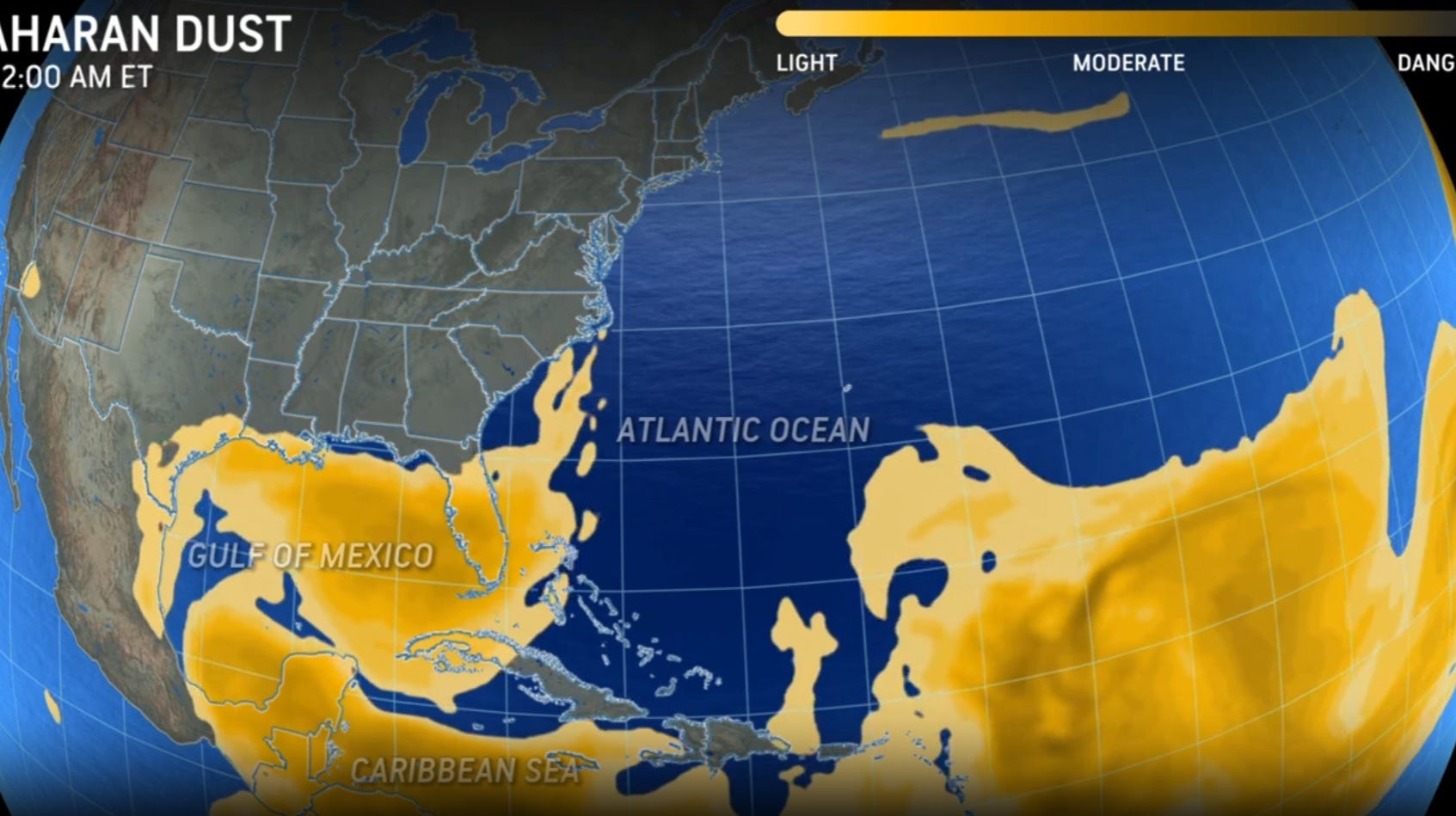
A plume of Saharan dust is on its way.
The dust emerges off the western coast of Africa and travels across the Atlantic. It can blow as far west as Texas, according to NOAA.
➤ Track all active storms
A big benefit to the Saharan Dust Layer is that it suppresses the development and strengthening of tropical cyclones.
What causes the Saharan Dust Layer?
Remember those tropical waves the National Hurricane Center is always monitoring? Those “ripples” in the lower to middle atmosphere track along the southern edge of the Sahara Desert and lift dust into the atmosphere.
The dust can be as thick as 2.5 miles, with the base starting about a mile above the surface of the Earth, according to NOAA.
Saharan dust helps prevent tropical cyclones
There’s a huge amount of dust, dry air and strong winds associated with the Saharan Dust Layer. All of those conditions make it difficult for tropical cyclones to develop or strengthen.
➤ Tropics watch July 17: Tropics remain quiet but for how long?
Is there a season for Saharan dust?
Activity typically ramps up in mid-June and peaks from late June to mid-August, according to NOAA.
New outbreaks occur every three to five days.
During its peak, Saharan dust can reach as far as Florida, Central America or even Texas.
It can cover a huge amount of the Atlantic Ocean, sometimes as large as the contiguous United States, NOAA said.
Saharan dust approaching Florida
A new plume of Saharan dust is approaching Florida.
“It looks like there is a wave that recently pushed off Africa making its way across the Atlantic,” said Zach Law, meteorologist with the National Weather Service, Melbourne. “Right now (Wednesday, July 17), the majority of it is to the east of the Leeward/Windward Islands
“It could move into the South Florida coast by Saturday morning. By Sunday morning, it’ll be around Cape Canaveral. The thickest layers will be across South Florida, since the dust will be dispersing as it moves north.
“The majority of it could be centered around South Florida, although some models show it could get into North Florida,” Law said.
What’s the biggest impact Florida will see from the Saharan dust?
“Generally, the dust will be most noticeable with some really pretty sunrises and sunsets,” Law said.
The dust also is keeping the tropics quiet, which is expected to last possibly toward the end of July, beginning of August, AccuWeather forecasters said.
Another wave of dust coming to Florida
A second wave of dust associated with the same plume could reach South Florida by Tuesday morning, Law said.
That dust shouldn’t be as thick as the dust expected to arrive over the weekend since it’ll be more dispersed by the time it reaches the Florida coast.
Source link : https://www.tcpalm.com/story/news/2024/07/17/saharan-dust-plume-impacts-arrival-across-florida/74437658007/
Author :
Publish date : 2024-07-17 12:05:22
Copyright for syndicated content belongs to the linked Source.
