
![]()
Hurricane Beryl hits Mexico, brings heavy rain and strong winds
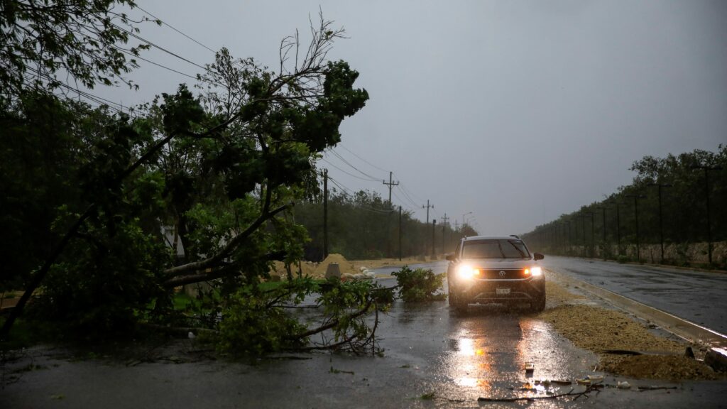
Hurricane Beryl arrived in Mexico after leaving destruction and 11 people dead in the Caribbean.
A hurricane watch was issued along the Southeast Texas coast Friday ahead of Beryl’s expected arrival along the Gulf Coast by Monday.
In its 10 p.m. Central update, the National Hurricane Center said the watch covers the Texas coast from the mouth of the Rio Grande north to Sargent, south of Galveston. A hurricane watch also is in effect for Mexico, from the mouth of the Rio Grande south to Barra el Mezquital.
Beryl is forecast to approach the coast of Texas and northeastern Mexico on Monday as a strong Category 1 hurricane with 90 mph winds, or potentially higher depending on how the storm gets reorganized and strengthens once it moves fully over the Gulf of Mexico. The entire Texas coast now lies within the hurricane center’s potential forecast for the center of Beryl’s path over the next five days
Whether it arrives as a hurricane or a tropical storm, where it might make landfall and how strong it might be once it finishes crossing Mexico’s Yucatan Peninsula remain uncertain.
The average margin of error at three days out is around 100 miles. Because of the angle of the storm’s approach, that margin could make a significant difference in where the biggest impacts occur.
The National Weather Service warns the chances are increasing for heavy rain, winds and storm surge in Southeast Texas and rainfall further north along the Gulf coast and into Louisiana as its remnants move through the region next week.
Beryl is forecast to produce 5-10 inches of rainfall in Texas, with up to 15 inches in isolated locations, across portions of the coast and in eastern Texas beginning late Sunday through the middle of next week, the hurricane center said. The storm also is forecast to deliver a storm surge amounts of 2-5 feet along the coast and dangerous rip currents.
Residents in Texas should be familiar with their flood zones – as well as those who live in Louisiana – and should be closely monitoring the storm’s progress, according to the hurricane center.
“All of South Texas should be preparing for a hurricane,” Kirsten Snodgrass, a meteorologist in Corpus Christi wrote in a Friday morning forecast update.
Even though heat is a concern going into the weekend, for those that live in Beryl’s potential path, now is the time to make sure preparations are complete, know your flood zone and check on your neighbors, especially those who may be vulnerable.
It’s important to know your risk, Michael Brennan, hurricane center director, told USA TODAY in March. It’s “knowing if you live in a storm surge evacuation zone.”
What is a hurricane watch?
A watch means hurricane force winds above 74 mph are possible within 48 hours.
What is a hurricane warning?
A warning means hurricane force winds above 74 mph are expected within 36 hours.
What’s the forecast for Louisiana and Texas?
After ripping through the Caribbean, brushing Jamaica and making landfall along the Yucatan Peninsula, the storm’s winds have weakened considerably, but the hurricane center’s forecasters aren’t quite sure what will happen once Beryl fully re-enters the Gulf of Mexico.
Its future wind strength depends on how much of its core remains intact, and its future path depends on how strong Beryl becomes and how it interacts with atmospheric systems over the southern United States. At 10 p.m. C.T. on Friday, the forecast called for Beryl to gradually intensify over the Gulf, making landfall as a Category 1 hurricane with 90 mph winds on Monday.
If Beryl becomes stronger, the likelihood increases that it would take a more northerly motion, wrote Jack Beven, one of the hurricane center’s hurricane specialists in the 11 a.m. forecast.
Some models suggest winds over the Gulf could favor the chances for Beryl “strengthening more than currently forecast, especially if the center stays over water longer than forecast,” Beven wrote.
Regardless of the path or intensity of the storm, life-threatening beach conditions are expected later today across much of the Gulf Coast and are forecast to continue through the weekend.
Track Beryl’s forecast
Forecasters say it’s important to monitor the storm’s progress, but remember the hurricane center’s forecast cone shows only the likely path of the center of the storm. Weather impacts could occur many miles away.
How to prepare your home
If you’re in an area where high winds are possible with Hurricane Beryl, here are things you can do to get ready.
Secure loose items in your yard that could be blown over, such as lawn furniture, grills, bicycles, etc.Check your emergency go-bag and medical supplies in case you must evacuateCharge your phoneFill up or charge your vehicle Help your neighbors, especially if they’re vulnerable.What is storm surge?
Brennan has said water is one of the greatest dangers in a hurricane, including storm surge, intense rainfall and rip currents. Storm surge occurs when the winds of a hurricane push the water higher than normal high tides, raising the ocean level, and then big waves occur on top of that. It’s one of the most destructive forces in a hurricane.
Understanding storm surge Graphics explain the deadly phenomenon
Preparing a kit
If you live in a low-lying area prone to flooding, you might be asked to evacuate and need to prepare an emergency “go bag” to take with you. As of Friday, the forecast called for up to 10 inches of rain in areas along the coast, with even higher amounts in isolated locations. A flash flood risk extends well east along the Gulf Coast into Louisiana by Tuesday.
Hurricane season is here: Here’s how to put together your preparedness kit or “go bag”
Beryl’s historic journey
Beryl was born as a tropical depression on June 28 and became a tropical storm later that evening. It broke records over the next several days for rapid intensification so early in hurricane season. It became a hurricane within 24 hours of formation. Within another 24 hours, its winds had increased 55 mph, reaching 130 mph, almost a Category 4 hurricane.
Hurricane Beryl: A history making path through the Caribbean
Beryl battered the Windward Islands along the eastern Caribbean, causing widespread destruction in Saint Vincent and the Grenadines and Grenada, destroying or severely damaging more than 90% of the homes and buildings on at least three islands. After plowing through the islands, Beryl again re-strengthened, becoming a Category 5 storm, then reaching winds of 165 mph on the morning of July 2.
Dinah Voyles Pulver and Doyle Rice cover climate and the environment for USA TODAY. Reach Dinah at dpulver@usatoday.com and Doyle at drice@usatoday.com.
Source link : https://www.usatoday.com/story/news/nation/2024/07/05/beryl-hurricane-watch-texas/74310580007/
Author :
Publish date : 2024-07-05 19:46:48
Copyright for syndicated content belongs to the linked Source.